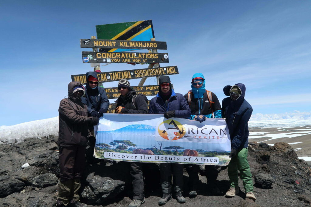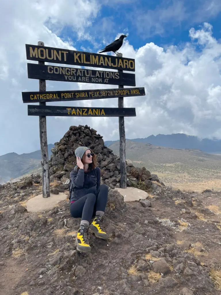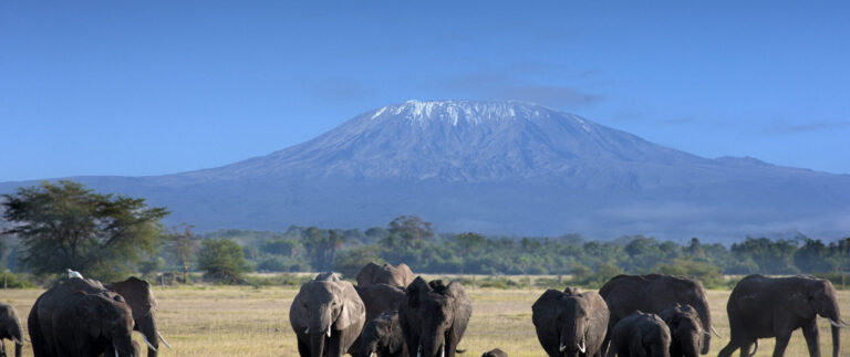
Mount Kilimanjaro
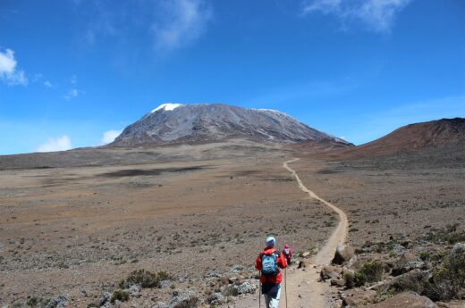
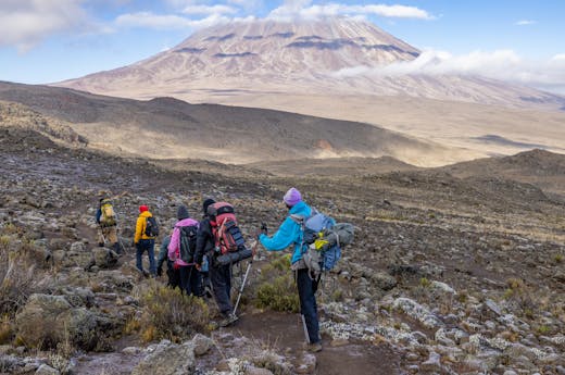
Mount Kilimanjaro, Africa’s highest peak, offers adventurers a stunning challenge with diverse routes and stunning landscapes, offering an unforgettable experience from base to summit.
Best Kilimanjaro Routes for Climbers
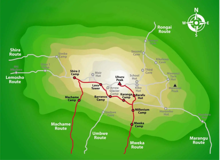
Machame Route
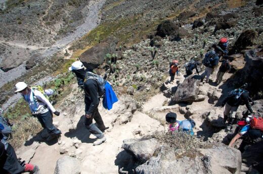
Referred to as the “Whiskey Route,” this route offers a more difficult challenge than the Marangu Route. But adding a day or two to allow for altitude acclimatization and adopting the ‘climb high, sleep low’ strategy greatly increases the likelihood of reaching the summit. Though there are some steep sections, with the right preparation even the formidable Barranco Wall is achievable.
Landscape
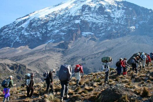
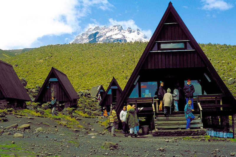
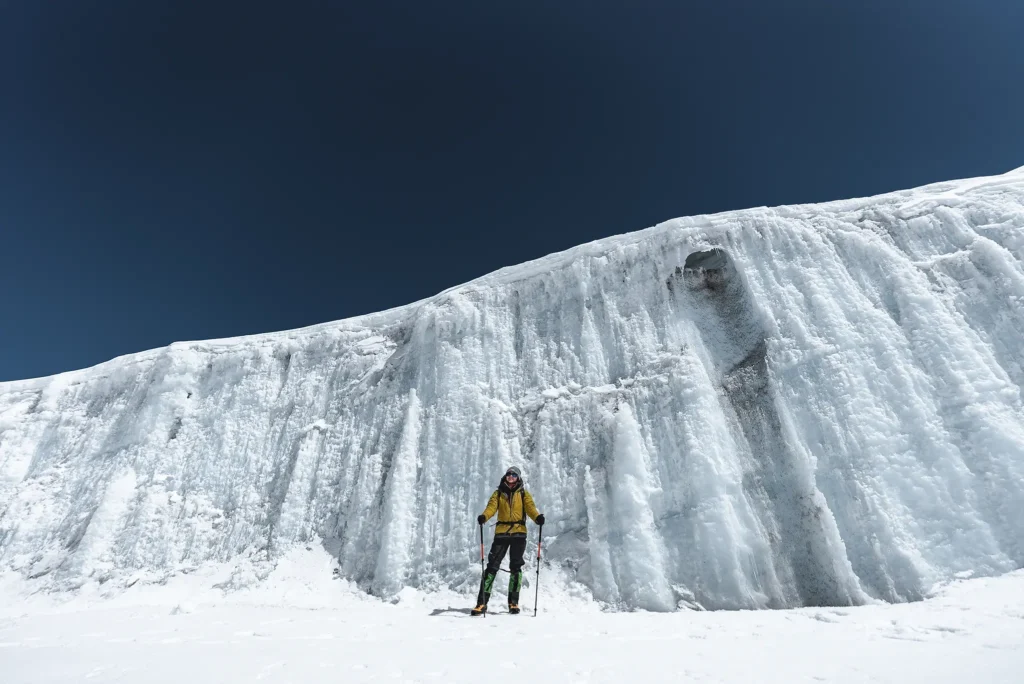
Starting in the southwest of the mountain the trek passes through forests, moors and 4 distinct climatic zones to reach the beautiful lunar landscape of the Shira Plateau and famed Lava Tower en route to the summit.
Highlights
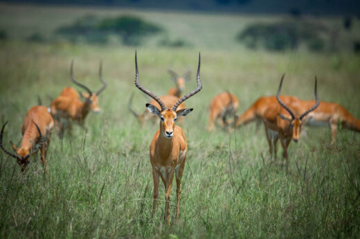
Spectacular scenery.
Difficulty Level
Moderately Difficult with 85% success rate
Distance
61 km over 6 – 7 Days

Marangu Route
Called the “Coca-Cola” route, it’s favored by less experienced climbers who prefer the comfort of huts over tents. This has led to the misconception that it’s easier, but the brief duration leaves little time for acclimatization, resulting in a lower summit success rate. To increase the chances of success, a 6-day climb is advised.
Landscape
Starting in the mountain’s southeast, the trek passes through forests, moors and 4 distinct climatic zones to reach the beautiful lunar landscape of the Shira Plateau and famed Lava Tower en route to the summit.
Highlights
Spectacular scenery.
Difficulty Level
Moderately Difficult with 85% success rate
Distance
Distance 70 km over 5 – 6 Days
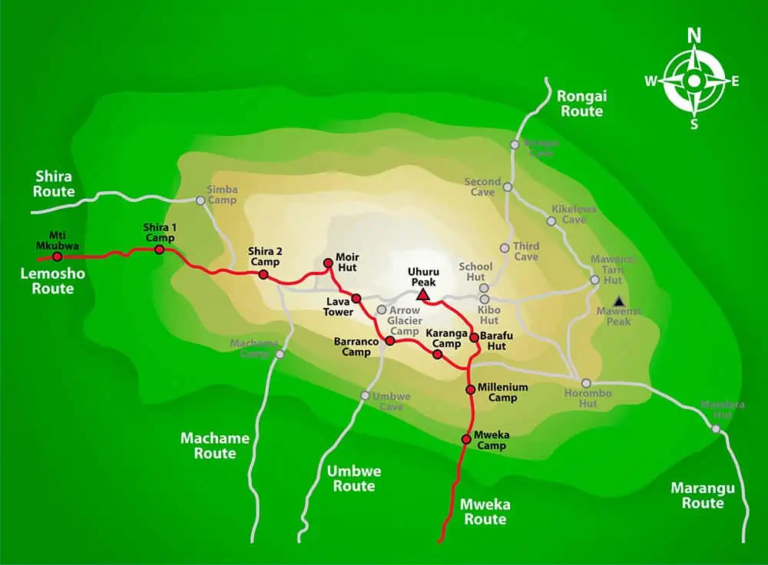
Lemosho Route
The Lemosho Route, renowned for its stunning scenery and higher cost due to its extended duration, starts on the western side of Kilimanjaro, following a path similar to the Shira Route. It crosses the Shira Plateau, ascends the Barranco Wall, and then faces a demanding summit day to reach Uhuru Peak. The descent takes place along the Mweka Route on the southern side of the mountain.
Landscape
The trail begins with two days of forest trails before heading over the moorlands to the Shira Plateau and the spectacular rock formations that follow. With views of distant Mount Meru, it is regarded as possibly the most breathtaking for its diverse scenery.
Highlights
Diverse scenery and a high summit success rate, with relatively few people.
Difficulty Level
Moderate difficulty with a 90% success rate.
Distance
67 km over 7 – 8 Days
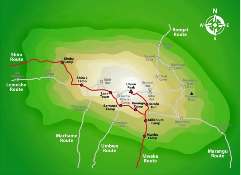
Shira Route
Despite similarities to the Lemosho Route for the latter part of the trek, it eliminates two days spent in the rainforest in favor of a direct steep climb up a 4×4 path, which means you can be driven to the official start at 3500m. So, while it might be shorter, this means that there is inadequate time to get used to the altitude, and this in turn leads to a low success rate among climbers. Even those that are acclimatized will need to be confident of their ability.
Landscape
Missing out entirely on the forest and moors at lower altitudes, much of the hike is spent on the starkly beautiful Shira Plateau (from which the route takes its name), before tackling the Barranco Wall and scree slopes en route to the summit.
Highlights
The views of the surrounding landscape below and Mount Meru in the distance. Less people than the Marangu and Machame Routes.
Difficulty Level
Difficult with an 80% success rate
Distance
58 km over 6 – 7 Days
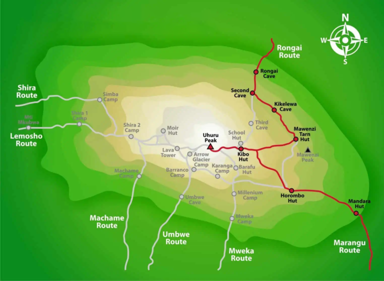
Rongai Route
As the only route that starts on the mountain’s northern side, it is drier than all the other routes – hence, preferred in the Wet Season. While it is less scenic, the trail gradient is sufficiently gradual and the camps are nicely spaced, meaning that there is ample time to acclimate. As fewer people choose this route, it also feels wilder and trekkers may even see some wildlife. From day three, the terrain is gentle if rocky and the shortened stage on the day before summiting is a welcome opportunity to rest before setting off at midnight for the summit. The descent trail follows the Marangu Route to the southeast, taking up to 2 days.
Landscape
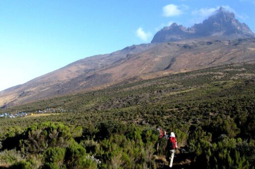
The trail begins in the farmlands before passing through the rainforest. This gives way to woodlands, moors, and ultimately the alien landscape of the ‘Saddle’. The descent via Marangu entails moors and rainforest once the rocky upper slopes are left behind. Highlights: For most, the scenic location of the campsite in the shadow of the Mawenxi Peak is the most memorable day of the hike (besides the summit, of course).
Difficulty Level
Relatively easy with an 85% success rate.
Distance
74 km over 6 – 7 Days
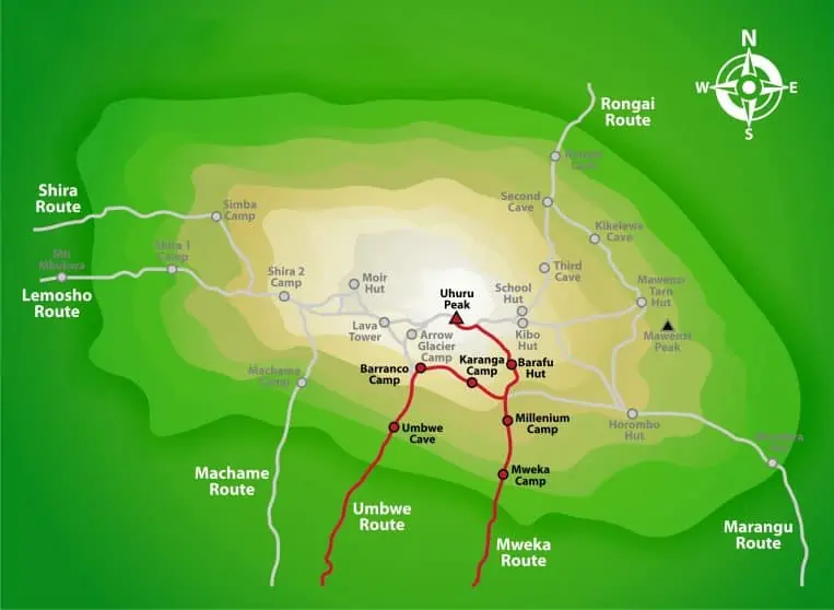
Umbwe Route
The rapid ascent to Barranco Camp in two – as opposed to the usual 3-4 – days, gives trekkers little time to acclimatize to the sharp change in altitude. The trail is steep and exposed, and not for those with a fear of heights. From Barranco, it shares the Machame Route to the summit. Umbwe Route should only be attempted by highly experienced trekkers using all 7 days.
Landscape
The first two days take trekkers through the rainforest before emerging onto the rock flanks of Kilimanjaro.
Highlights
It is quiet and remote. Reaching Uhuru Peak – only the most experienced climbers do.
Difficulty Level
Very difficult. Experienced climbers only – a 70% success rate.
Distance
48 km over 5 – 7 Days
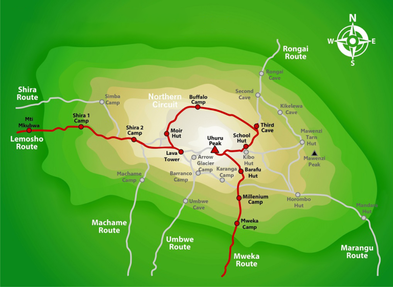
Northern Circuit
Due to its length, the Northern Circuit, extra time for acclimatization, and ‘climb high, sleep low’ routing, trekkers on the Northern Circuit enjoy the highest success rate. The first two days follow the Lemosho Route before veering toward the Lava Tower and around the empty northern flanks of the mountain at around 4000m, until linking up with the Rongai Route which is followed to the summit at Uhuru Peak. The descent follows the Mweka Route, where the abundance of trekkers stands in stark contrast to the solitude at the start of the climb.
Landscape
The first two days pass through rainforest and moorlands before venturing onto the open slopes at altitude.
Highlights
The solitude for much of the route and spectacular views, particularly on the northern slope.
Difficulty Level
Relatively easy but long, with 95% success rate.
Distance
88 km over 8 – 9 Days