Overview
The Lemosho Route is renowned for its picturesque vistas, abundant wildlife, and gradual acclimatization, making it an ideal choice for climbers seeking a more extended and rewarding journey to the top of Kilimanjaro. This route provides an opportunity to experience the diverse ecosystems of the mountain, from lush rainforests to alpine deserts.

History and Significance
The route’s early history can be traced back to local Chagga and Maasai tribes who used the mountain for various cultural and spiritual purposes. Mount Kilimanjaro, with its three volcanic cones – Kibo, Mawenzi, and Shira, has held a special significance in the lives of these tribes, who consider it sacred.
It was not until the mid-20th century that Kilimanjaro started attracting international attention as a premier climbing destination. The first recorded ascent to the summit was achieved in 1889 by German geographer Hans Meyer and Austrian mountaineer Ludwig Purtscheller, using the Marangu Route. Over the years, various routes were established, and the Lemosho Route was gradually discovered for its scenic beauty and excellent acclimatization opportunities.
Advantages of Choosing Lemosho Route
- Scenic Beauty – The Lemosho Route treats trekkers to an ever-changing panorama of breathtaking landscapes. From dense rainforests teeming with unique flora and fauna to sweeping moorlands adorned with otherworldly plants, the journey is an expedition through nature’s finest artwork.
- Enhanced Acclimatization – The route’s extended duration allows for better acclimatization, reducing the risk of altitude sickness. This contributes to a higher chance of reaching the summit successfully, making it an attractive option for climbers.
- Lower Crowds – Compared to some of the more popular routes, the Lemosho Route sees fewer trekkers, ensuring a more tranquil and intimate experience with nature. It offers a sense of seclusion and adventure that many seek when climbing Kilimanjaro.


Preparing for the Lemosho Climb
- Physical Fitness – Ascending Mount Kilimanjaro is physically demanding. Trekkers should engage in regular exercise and endurance training to build the stamina necessary for the journey.
- Packing Essentials – Packing wisely is crucial for a successful climb. Important items include proper clothing for varying climates, sturdy hiking boots, sleeping bags, water bottles, and essential personal items.
- Acclimatization Strategy – Trekkers should adhere to the “pole pole” (meaning “slowly slowly” in Swahili) principle, allowing the body to adjust gradually to changing altitudes and reducing the risk of altitude-related issues.
8 DAY LEMOSHO ITINERARY
DAY 1 – Londorossi Gate to Mti Mkubwa
After traveling for about 4 hours from Moshi, we arrive at the Londorossi Gate, where you must complete the entry procedures. the Lemosho trailhead next by driving there. At the trailhead, we start our hike through the untouched forest that leads to the first campsite.
Elevation: 7,742 ft to 9,498 ft
Hiking Time: 3-4 hours
Distance: 6 km | 4 miles
Habitat: Rain Forest
DAY 2 – Mti Mkubwa to Shira 1 Camp
On the trail leading out of the rainforest and into a savannah of tall grasses, heather, and volcanic rock covered in lichen beards, we continue. We reach the Shira Ridge before descending gently to Shira 1 Camp as we ascend through the lush, undulating hills and cross a number of streams. Here, we get our first look at Kibo from the other side of the plateau.
Elevation: 9,498 ft to 11,500 ft
Hiking Time: 5-6 hours
Distance: 8 km | 5 miles
Habitat: Health
DAY 3 – Shira 1 Camp to Moir Hut
We spend the entire day exploring the Shira Plateau. A leisurely stroll through moorland meadows leads to Shira 2 Camp. Then we leave the main trail and head off to Moir Hut, a remote location at the foot of Lent Hills. Lent Hills offers a wide range of walks, making this a fantastic chance to acclimate. One of the highest plateaus on the planet is the Shira Plateau.
Elevation: 11,500 ft to 13,800 ft
Hiking Time: 5-7 hours
Distance: 11 km | 7 miles
Habitat: Health
DAY 4 – Moir Hut to Lava Tower to Barranco Camp
We start the day by ascending a ridge and then move southeast in the direction of the 300-foot-tall Lava Tower, a volcanic rock formation. We descend to an elevation of 13,000 feet before entering the strange but lovely Senecio Forest. Even though you start and end each day at the same elevation, spending time at a higher altitude helps your body adjust to the higher altitude.
Moir Hut to Lava Tower
Elevation: 13,800 ft to 15,190 ft
Hiking Time: 4-5 hours
Distance: 7 km | 4 miles
Habitat: Alpine Desert
Lava Tower to Barranco Camp
Elevation: 15,190 ft to 13,044 ft
Hiking Time: 2-3 hours
Distance: 3 km | 2 miles
Habitat: Alpine Desert
DAY 5 – Barranco Camp to Karanga Camp
We start the day by making our way down a ravine to the Great Barranco Wall’s base. Then we ascend the nearly 900-foot cliff, which is not technically difficult. We travel through a number of hills and valleys after leaving the top of the Barranco Wall before making a sharp turn into the Karanga Valley. We have one more steep ascent before we reach Karanga Camp. Acclimatization is the goal of today’s shorter day.
Elevation: 13,044 ft to 13,106 ft
Hiking Time: 4-5 hours
Distance: 5 km | 3 miles
Habitat: Alpine Desert
DAY 6 – Karanga Camp to Barafu Camp
After leaving Karanga, we arrive at the intersection where the Mweka Trail joins it. We keep going up the rocky slope to Barafu Hut. You have now finished the Southern Circuit, which provides views of the summit from a variety of angles. We set up camp here, take a nap, and eat a leisurely dinner before the summit day. From here, one can see Mawenzi and Kibo, the two peaks.
Elevation: 13,106 ft to 15,331 ft
Hiking Time: 4-5 hours
Distance: 4 km | 2 miles
Habitat: Alpine Desert
DAY 7 – Barafu Camp to Uhuru Peak to Mweka Camp
We start the ascent very early in the morning (around midnight). The hardest part of the trek both physically and mentally is this section. At this altitude and time of day, the wind and cold can be very strong. We climb in the dark for several hours, stopping frequently but only briefly. You will be rewarded with the most breathtaking sunrise you are ever likely to see approaching Mawenzi Peak close to Stella Point (18,900 feet). Finally, we reach Uhuru Peak, which is both Mount Kilimanjaro’s and Africa’s highest point.
We now begin our descent from the summit, going straight down to the Mweka Hut campsite while stopping at Barafu for lunch. Trekking poles are helpful because the trail is very rocky and can be quite taxing on the knees. Due to its location in the upper forest, Mweka Camp may experience late-afternoon mist or rain. We have our final meal on the mountain later in the evening before a well-earned rest.
Barafu Camp to Uhuru Peak
Elevation: 15,331 ft to 19,341 ft
Hiking Time: 7-8 hours
Distance: 5 km | 3 miles
Habitat: Arctic
Uhuru Peak to Mweka Camp
Elevation: 19,341 ft to 10,065 ft
Hiking Time: 4-6 hours
Distance: 12 km | 7 miles
Habitat: Rain Forest
DAY 8 – Mweka Camp to Mweka Gate
We continue the descent to Mweka Gate on our final day, where we pick up the summit certificates. It might be muddy and wet at lower altitudes. We travel another hour to Mweka Village from the gate. We’ll be picked up by car at Mweka Village and taken back to our Moshi hotel.
Elevation: 10,065 ft to 5,380 ft
Hiking Time: 3-4 hours
Distance: 10 km | 6 miles
Habitat: Rain Forest
Travellers all around the world are loving Us!
Don't pass up your chance to embark on the trip of a lifetime with the top tour operator in the area.
5 Overall Satisfaction Rating!
Based on 300+ Reviews
As a father of five sons, I made a promise to them to take them on a 7-8 day trip to a destination of their choosing. I went with my oldest son to Egypt, my second one to Zimbabwe and Zambia, and my third to…
Godfrey is very attentive and organized everything well.We climbed Kilimandjaro: we felt safe, and very well supported with more comfort than we expected!The team was wonderful, especially our guides Mohamed and Thadeus. Special thanks to Betto for his joy throughout the journey, Jose the best…
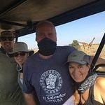
Leaving from Arusha, we went on a one day Safari to Tarangire National Park with Ben as our guide. Ben was very knowledgeable about the animals and the indigenous Maasai people. It was so much fun to check off of our list all of the…
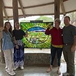
Our 4 days safari with African Traits was amazing! Cosmas was an exceptional guide that could speak fluently French (as well as Spanish, English and Swahili) so my parents could understand everything that was going on. Our driver, Denis, was driving like a pro and…